research
OCEAN project: a collaborative data sharing platform supporting enhanced situation awareness to reduce the risk of collision during navigation
Published: 14/10/2024
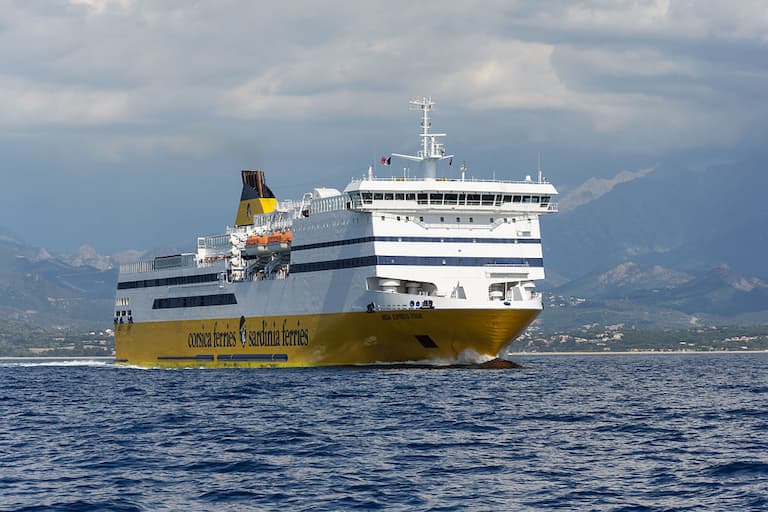
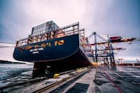
Photo: Myrabella / Wikimedia Commons / CC BY-SA 3.0
Around 3,000 maritime incidents occur every year in the European maritime fleet. 28% of these accidents are categorised as severe or very severe accidents.
CIMNE is working with twelve other European partners to address maritime safety head-on through the OCEAN project (Operator-Centred Enhancement of Awareness in Navigation), an international initiative focused on enhancing operator awareness in navigation.
Experts from CIMNE's transport innovation unit, CENIT, are involved in this effort to reduce the frequency of serious accidents such as collisions and groundings, to protect the lives of marine mammals and to reduce the risk posed by floating obstacles. Through a transversal approach, OCEAN will promote safer practices by improving the usability of instruments and creating a Decision Support System for mariners.
Using human-centred design, which prioritises people’s needs and behaviours in product and service design, the project will utilise cutting-edge technology, such as AI algorithms, to enable sea crews to make better decisions, improving safety and protecting the marine environment.
The project aims to enhance operational efficiency and protect marine life by adopting advanced technology such as hydrophone grids, satellite imagery analysis and prediction models for both marine mammals and container drift while addressing many critical aspects including:
-
Navigational accidents root cause assessment
-
Enhanced Professional Standards for Situation Awareness
-
Human-centred Bridge Equipment Design Methods
-
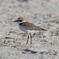
Detection and tracking of Marine Mammals in high-density areas
-
Tracking and Recovery of Floating Containers
-
Improved Situation Awareness and Manoeuvring Planning
-
Automated Anti-collision Solutions & Shipboard Infrastructure
European Navigational Hazard Infrastructure
In addition to streamlining operations and protecting marine life, the project seeks to build the so-called European Navigational Hazard Infrastructure (ENHI), a system with the capability of receiving data concerning observations, detections and predictions from multiple data streams and able to optionally share part of this data with other components of the data ecosystem. This way, interfaces and formats to exchange data have been defined to support multiple sources. Mechanisms have also been developed to manage data in a proper way in terms of consistency, persistence and quality. Overall, from a design perspective, the ENHI can be seen as the sum of all the components depicted in the following diagram:

-
I/O Interfaces: Input and output interfaces defining how data is received and sent between the components of the OCEAN ecosystem.
-
Data Storage: Implements the underlying information system used to store both active data and historical information (expired data).
-
Management: Includes all the rationale implementing the use cases as well as supporting features concerning the control of accuracy, consistency and uniqueness.
-
Publishing: Feature used to build Navigational Warnings before they are published/delivered to the end users.
The image below illustrates the envisaged workflow in the OCEAN data ecosystem. As a general overview, reporting data is sent to the ENHI which, depending on the configuration of the system, can optionally request additional data to two on-demand components in charge of detecting containers or marine mammals through the analysis of satellite imagery or predicting the drift of a given container. The second half of the project (from April 2024 on) will address the support to the generation of Navigational Warnings (NW) to be delivered to the ships through existing communication channels as well as the incoming data product based on the International Hydrographic Organization S-100 framework specification.
For a better understanding of the whole system, the following list briefly outlines the most relevant features of the involved components:
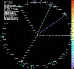
Passive Acoustic Monitoring (PAM) |
|
|
|
|
|
|
|
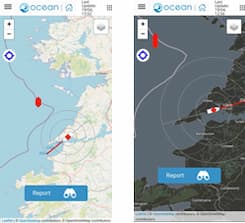
Reporting app |
|
|
|
|
|
|
|
Environmental Niche Models (ENM) |
|
|
|
|
|
|
|
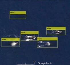
Satellite Imagery Analysis |
|
|
|
|
|
|
|
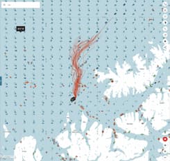
Container Drift Model |
|
|
|
|

The ENHI gathers near real time data concerning hazards from many different sources and provides mechanisms to generate NW that can be used to feed mariners with valuable information in order to replan the routes in advance or support manoeuvres during the voyages with the objective of avoiding collisions.
The OCEAN Project is an innovation and development initiative co-funded by the European Union. UK participants are supported by UK Research and Innovation Grant Number 10038659 (Lloyd’s Register) and Grant Number 10052942 (The Nautical Institute)
Adaptation of an original article written by CIMNE’s Francisco Miguel Rodero Blanquez
Related items