The growing overcrowding of natural areas may put ecosystem quality at risk. To assess anthropogenic impact in natural parks, a study by the International Centre for Numerical Methods in Engineering (CIMNE) and the University of Lleida (UdL) has proposed a simple, low-computational-cost tool that uses computer vision to measure human activity and its effects in these environments.
The challenge of digitising biodiversity
Catalonia is home to around twenty natural parks, many of which are increasingly threatened by high levels of human presence. However, there is little data on visitor numbers or how these spaces are actually used. PIKSEL is a collaborative project between CIMNE and the Government of Catalonia aimed at developing an integrated knowledge platform to support the sustainable management of ecosystems and land use.
To help prevent biodiversity loss, one of PIKSEL’s key objectives is to assess anthropogenic pressure across Catalonia’s ecosystems, both terrestrial and marine. By leveraging computer vision powered by machine learning models, the project seeks to continuously quantify visitor activity, identifying which parks are most affected depending on the day of the week, season, or time of year, and examining how this correlates with the gradual loss of biodiversity.
However, this technology faces several challenges, including the accurate, real-time counting of moving objects in complex environments subject to constant changes in weather conditions, such as temperature shifts, rainfall and varying light levels. In addition, deployment in rural or remote areas requires efficient, low-power solutions, ideally autonomous, capable of running on lightweight devices, often with limited connectivity.
An affordable detection model
A new study proposes a detection method that addresses these limitations. The work forms part of the doctoral research of Dr Oluwakemi Akinwehinmi, a researcher in the Innovation Unit for Pre-, Post- and Digital Technologies (DIGIT), supervised by Dr Pedro Arnau and Dr Alberto Tena from the same unit, and Dr Javier Mora from the Structural and Particle Mechanics research cluster at CIMNE.
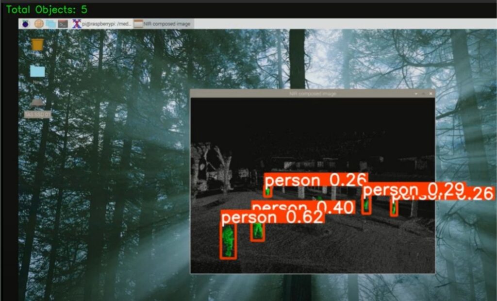
The detection and counting system is based on advanced artificial intelligence (YOLOv8n), a computer vision architecture that optimises resource use through a multi-threaded computing design, enabling efficient operation on low-power devices. This approach allows real-time video stream processing while significantly reducing latency compared with traditional sequential methods.
A key feature of this technology is its design for unstructured environments, which enhances detection performance under sudden lighting changes, partial occlusions and limited-resolution sensors. The codebase is also optimised for low-power hardware, reducing its digital footprint and improving overall sustainability. Together, these features enable the cost-effective and practical deployment of a more stable and consistent human presence monitoring system in rural settings, even when movement patterns are irregular or processing loads fluctuate.
Data-driven sustainable management
Having continuous information on human presence in natural areas makes it easier to identify peak pressure periods and hotspots, allowing management and protection measures to be tailored to the specific needs of each ecosystem. The tool provides real-time data that environmental managers can use to move from reactive observation to proactive, evidence-based conservation.
Beyond biodiversity monitoring, this approach can be applied to other domains requiring efficient, real-time video analysis in unstructured environments, broadening its potential as a technological solution for smarter territorial management.
Akinwehinmi, O., Tena, A., Mora, J., Solsona, F., Arnau del Amo, P., 2026. Real-time habitat mapping with YOLOv8: A multi-threaded approach to biodiversity preservation. Comput. Vis. Image Underst. 263, 104606. https://doi.org/10.1016/j.cviu.2025.104606